En Route to Surrey from Maryville Tennessee

Tuesday, October 26, 2004

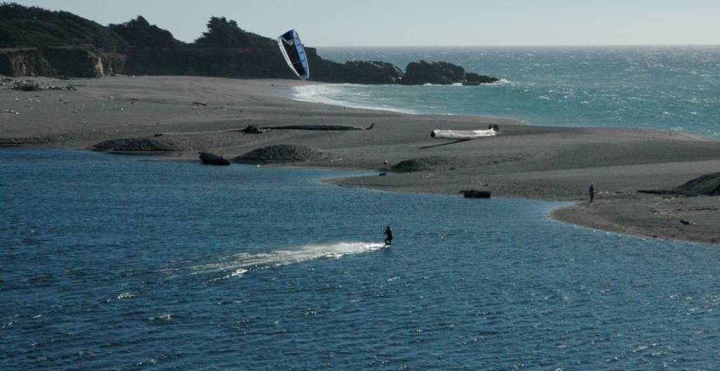
Hwy 101 closed north of Florence

After I took the last photos of waves breaking on the shore, I found out at Florence that Hwy 101, the coastal highway was detoured onto the hwy into Eugene OR. Because I had already captured some Oregon wave action, I decided that this detour would signal the end of my trip. Tonight I'm at a Best Western in the north end of Portland, and expect to finish up in Surrey tomorrow.

I hope you've enjoyed the photos as much as I enjoyed taking them. The Nikon D70 is one heck of a digital camera. It's been a great companion to have along.


And so we come to the last photo I'll be posting this trip. Mission accomplished.


Finally, the last objective I had for this trip was to see some wave action along the Oregon coast. I'm not quite sure if I caught this north or south of the CA-OR state line, but it is a good representation of what I did see in Oregon.


Here is another view taken at the same spot. I like the colours. As you can see, the trees don't look so big as long as you don't look up.


It's hard to realize just how big these redwoods are when you drive through the forest...The photo captures the height quite effectively. This was taken along the Avenue of the Giants.


I caught this "shark fin" rock a short distance up the highway from Gualala...

Sunday, October 24, 2004

At a motel in Gualala CA on Hwy 1

The coastal highway #1 from the Golden Gate Bridge to Gualala is very winding and scenic. The turns come up so fast that half the time you're doing not more than 25 mph. I covered about a hundred miles in 4-1/2 hours of driving. The trip is worth taking as the photos may attest to what may be expected at points all along the highway. I wonder what the rich are doing? ....right, I have to keep reminding myself.


I've stopped for the night at Surf Motel in Gualala (pronounced) wa-LA-la, and happened to catch this kite-surfer in action looking down from the motel. I didn't ask if the motel had wireless capability, but when I was setting up to transfer the day's shoot, the computer detected several signals in the area. I don't know who owns it, but thanks, whoever you are!


This is what the seagull in the last photo was looking at...and it's my parting photo of this great surfing beach area.


How cool is this? Bodega Bay cool.


After a late morning start which took me over the Golden Gate Bridge (the bridge is actually a rusty red colour) and along coastal hwy #1, I caught this image at Bodega Bay.


Here's another sample of the scenery on the pathway.


Just a shadow of myself these days...on the bike for only the second time this trip. This is on the very popular pathway running parallel to Venice Beach. I've never seen so many joggers excepting organized runs for charity. There aren't many in this photo, but people were out jogging all over the place. The bike allowed me to cover a very large area in a short period of time.


Here's a view often seen in LA movies, of the Santa Monica pier on Venice Beach.


Venice Beach early Saturday morning. This is the most popular LA beach area at one end of Santa Monica Blvd.

At a San Mateo motel near San Fran

Here it is Sunday morning, the first chance I've had in a few days to upload photos. I had the bike out yesterday morning for a cycle up and down the pathway at Venice Beach. I went to a Farmers' Market in Santa Monica, bought some delicious grapes, the kind that make sunkist raisins, and also the best honey I've ever tasted, made in the orange groves.

I'm almost all "gawked" out, having traveled almost 14ooo kms so far. All I want to do in San Francisco is cross the Golden Gate bridge! I'll leave the cable cars on their journeys half way to the stars for some other time. Hwy 101 is very scenic, and lots of well tended fields. This is the first time I've seen in very large numbers, Mexican intinerant pickers at work.

Time to get movin'.


A shot taken at Long Beach. The Queen Mary is in the background. The Catalina ferry runs once a day, and didn't fit into my schedule.


The Kodiak Theater shares the same block as the Gruman Theater.


The Gruman Chinese Theater.


The Gruman theater is on the left and on the right side of the photo you can see the name Kodiak Theater, the place where academy awards are given out. The foot and hand prints of the stars are in the area where there's a crowd of people milling about.


Yeah, and I've got a million snaps of the pavement stones...too many to publish here.


Fred Astaire wasn't the only hoofer who left a mark on the plaza at Gruman's Theatre Complex.


Hooray for Hollywood! I spent two days here, went to see Taxi at the Gruman Chinese Theatre complex. The sound was state of the art using JBL speakers. The Metro Line was a great way to understand the layout of the LA area. I used it to visit Long Beach. Yesterday I drove along Santa Monica Blvd to Venice Beach, crossing Rodeo Drive in Beverly Hills, and came back to Hwy 101 North Bound thru Brentwood. EVERYBODY jogs on Saturday morning.


About the only animals in the zoo enjoying the moment...these sogging wet camels were a sight to see.


I've enhanced this photo to compensate for the poor lighting at fast shutter speeds. This Orang is caught in very swift movement.


The great ape exhibit is a major attraction here...but the rain and poor lighting made photo taking difficult. This is a cropped study through some very dirty glass,


It was raining while I visited the San Diego Zoo, and so most of the animals were under cover. These birds didn't seem to mind the rain.

Friday, October 22, 2004

...still in Hollywood

I'm at a motel on Sunset Blvd. Yesterday was the first day I had the bike out of the car. It was invaluable for checking out the general area and looking at all the sidewalk stars...running for blocks on both sides of Hollywood Blvd. I'm going to use Metroline, the rapid transit system, and maybe check out Long Beach. That depends upon what I see along the way.

Yesterday I saw a movie at the local cinerama theatre, Shark Tale. It happens to be the only movie due to start when I looked into the theatre. It was pretty good and the theatre was worthy of its locale.

Today, if Taxi is showing at the Gruman Theatre (the one with the handprints and footprints of famous stars), I'll check that out too.


Thursday, October 21, 2004

Change of plans....now in Hollywood

I decided I had seen enough of Arizona, and so instead of Phoenix, I went to San Diego. I got rained out at the San Diego Zoo, went north into the maze of LA freeways, and to make a long story short, used up some of my morning energy to steer the car into Hollywood. I'm at a Kinko's copy center where public computers are set up at 20 cents a minute. My current location is on Vine one half block off Sunset Blvd. This might be a good location to park for a few days and get on the bike.

Tuesday, October 19, 2004

at Eloy AZ Flying J truck stop

I spent the better part of the morning roaming around 75 acres of aircraft at the Tucson Pima Air Museum. I'll post some photos somewhere down the road from here. American and Russian fighter jets, and old WWII aircraft highlited the visit. I saw the first "wild" Saguaro cacti along Hwy 10 from Tucson to this location.


A view like this usually finds its way into literature advertising the site...


Another view of the hike path


What an area!


The pathway leads by strange sights at every turn..


A passage way on the hike...


It's hard to suggest scale. I'm up close to these rocks and they're massive.


This was taken as I hiked along the trail through the rock formations in the Chiricahua area.


...and Wyatt Earp is still after the bad guys


Big Nose Kate still makes money. Ol' doc would be proud...


Entertainment Center of old Tombstone


Wyatt Earp and Doc Holiday and friends


Here's a view looking down the street from the O.K. Corral

Been to Tombstone AZ and Chiricahua area...

I spent yesterday hiking around some wild rock formations in the Chiricahua area. Cochise and Geronimo belong to the apache people linked to this area. Tombstone AZ was deserted while I clomped along the boardwalk taking photos.


Geronimo linked his past to the Gila area, although his tribe did not occupy the cliff site, abandoned about 700 years ago.


A last look at the site


Another view of the Gila Cliff Dwellings


A view of the Gila Dwellings.


This photo speaks for itself.


hwy to Gila Cliff Dwellings, north of Deming AZ. There are some vehicles on the road at the turn for some idea of scale.

Saturday, October 16, 2004

West of El Paso on Hwy 10

I woke up this morning and decided I wanted to be in another state today. It's early afternoon at a Flying J truck stop on the border at New Mexico. It's sunny and hot. I'm almost over the cold I've had for the past week. El Paso is a very large spread out city. My camera is in the bag today. I'm planning to visit the site of Geronimo's surrender which is off hwy 80 south from Hwy 10. It looks like the site is in Arizona. There's still a lot of travel and sight-seeing left on this trip. The car is performing very well.


Desperados fill the cemetery.


In the village at the local funeral parlour...


Here's the set in the movie...


North of Bracketville Tx, is Alamo Village, the set of the John Wayne movie made in 1959.

Wednesday, October 13, 2004


An old funeral coach in a shop in New Orleans...I wandered thru six square blocks of the old French Quarter...and wasn't impressed. As I left the city I saw the huge old "cemeterie" north of Hwy 10. If I hadn't already been to an aquarium and a zoo and on a boat ride, I might have been attracted to that circuit offered in New Orleans.


At Biloxi, dramatic skies, white beaches, and in the background of this picture, a boat called Hurricance Camille, and a large building, the Grand Casino.


I saw a few cotton fields along Hwy 90 from Mobile to Biloxi...